Section 1 Kat O to Tung Wan
Swimming between three desolate islands
Difficulty ** | Time 3 hrs | Distance 9 km | Transport to start Ferry to Kat O from Ma Liu Shui | Hammocks Tung Wan Beach | Food Kat O |
Water feature Sea swims between 3 islands
| argyle_ross_sec_1.gpx |
Section 1 information
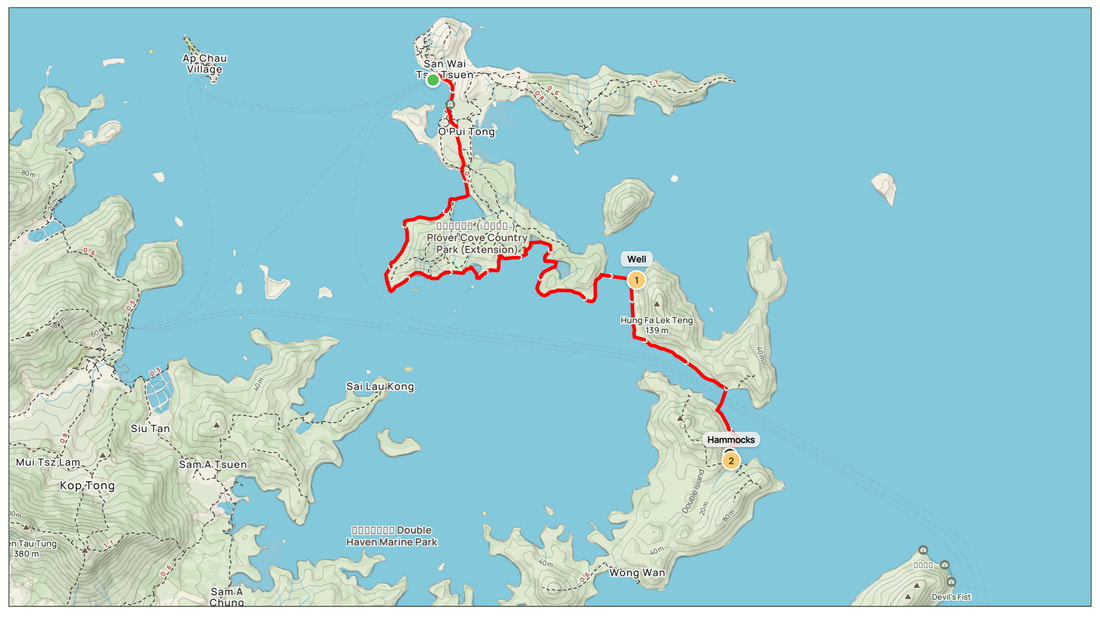
The Argyle Ross Trail begins in one of the most remote, beautiful corners of Hong Kong. The first two sections will take you hiking, coasteering and swimming around three stunning islands in the Double Haven area of Plover Cove Country Park, most likely places you have never been before. These two sections have been designed to be completed over a weekend with a night’s camping on Tung Wan beach or combined into a tough single day.
To reach the starting point of Section 1 you must catch the ferry from Ma Liu Shiu to Kat O (9am Sat, Sun and public holidays only). From the pier you take a short hike south before starting to swim and coasteer around the western and southern coastline of Crooked Island to a scenic v-shaped beach. However much you do of either is up to you. Coasteering is generally quicker but swimming in this clear water amidst stunning scenery is the highlight of Section 1. You will have the whole sea to yourselves apart from the odd canoe or fisherman.
When you reach the southeastern tip of Crooked Island you are at the closest point to Crescent Island and a leisurely 400 metre swim directly east will take you there in about twenty minutes. Foot protection is essential to protect you from the very sharp barnacles on entry to and exit from each swim. Make sure you look out for a man-made “bath” of rainwater and runoff in the middle of this small stretch of coastline on Crescent Island. It is like a coastal oasis in the afternoon heat. Filling up here will set you up perfectly if you are planning to camp on Tung Wan later that day as there is no water supply at the beach.
The last part of Section 1 is to coasteer around the south side of Crescent Island and cross over the Chik Mun Chau channel to Double Island at its narrowest point. It’s worth noting that this channel, although not busy, is where the Kat O ferry and other boats pass so be careful with your timings. You will find Tung Wan beach easily enough on the northeastern part of Double Island, a lovely crescent shaped cove with trees on the north side of the beach to sling your hammock up for the night.


